
Just outside of Dublin but worlds away from the hustle and bustle, the Ancient Wicklow Mountains offer some of Ireland’s best-loved Ways.
Just outside of Dublin but worlds away from the hustle and bustle, the Ancient Wicklow Mountains offer some of Ireland’s best-loved Ways.
The Wicklow Way is Ireland’s oldest waymarked trail, dating back to the 1960s, and it is still one of Ireland’s most popular walking routes. Starting just a 90-minute drive from Dublin airport, the Wicklow Way runs 132km from Marley Park in Dublin to Clonegal in County Carlow. It crosses the Wicklow Mountains on forest trails, mountain paths, and the occasional stretch of quiet country road. At a few points, the route follows the “Military Road”, constructed by the British in the early 19th century to gain access to the lower regions of the county and the Irish rebels hiding within!
The Wicklow Way is one of the best-managed hiking routes in the country. It is a pleasure to walk, well signposted, with rougher sections of the track graded to prevent erosion. The central section of this hiking route traverses the Wicklow Mountains National Park, passing through the historic and stunning Glendalough valley. The route doesn’t pass through many towns or villages, so most of the day-to-day walking is peaceful and quiet.
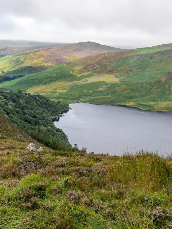
The phenomenal views, landscapes, and valleys of the Wicklow Mountains are the highlight of the Wicklow Way. From the border with county Dublin, these stunning mountains cover the middle and west of the county, running south to the Wexford border. The highest point in the Wicklow Mountains is Lugnaquilla at 926m. The hills were smoothed during the Ice Age, and wonderful deep glacial valleys were formed. The Glenmacanass, Glenmalure, and Glendalough valleys provide incredible views and also plenty of legwork for the aspiring walker!
Nestled in the striking valleys and hidden in the uplands, the Wicklow Way offers a plethora of tranquil lakes along its paths. Settle down on the banks of Glendalough to eat your lunch, or soak your feet in one of the smaller mountain lakes in unlikely high places. Each is completely unique, from the dark water of Wicklow’s bog pools to the shimmering reflections in Loch Tay.
Wicklow and its mountains are full of culture and history. From military roads to famine walls, and graveyards to churches, a walk on the Wicklow Way is a walk through time itself. There are plenty of opportunities to stop and explore cultural highlights, including the Powerscourt House and Gardens on the edge of Dublin and the four-hundred-year-old Huntington Castle in Clonegal.
Plan to spend at least a few extra hours discovering the remains of the monastic city and the round tower at Glendalough. Close by, the Wicklow National Park Visitor Centre is also worth a visit. For those with an interest in military history, a visit to the Drumgoff Barracks is recommended. Of course, the endpoint of the Wicklow Way is Dublin city, a thriving hub for all things history and culture, loaded with museums, galleries, theatres, parks, and more.
Choose the Walking & Hiking Itinerary that suits you best.
The full Wicklow Way is rated STRENUOUS but our tours provide options for shorter walking days. Navigating is easy with excellent waymarking and our detailed Route Notes and maps. Our Wicklow tours are appropriate for walkers with good fitness, comfortable walking 15-23 km (9-14 mi) per day with ascents up to 540 m (1,772 ft). Our tours include optional routes, so please look at daily itineraries for details regarding daily distance and ascents.
Don’t see an option that fits your needs? Let us design an itinerary that works for you!