The Dingle Way is a circular route of 179km (112mi) circumnavigating the Dingle Peninsula west of Tralee in County Kerry. It follows minor roads, traditional access routes to turf cutting areas and forest paths. The only high ascent is 600m, crossing the shoulder of Brandon Mountain between Ballydavid and Cloghane. This route is well marked and achievable by all walkers.
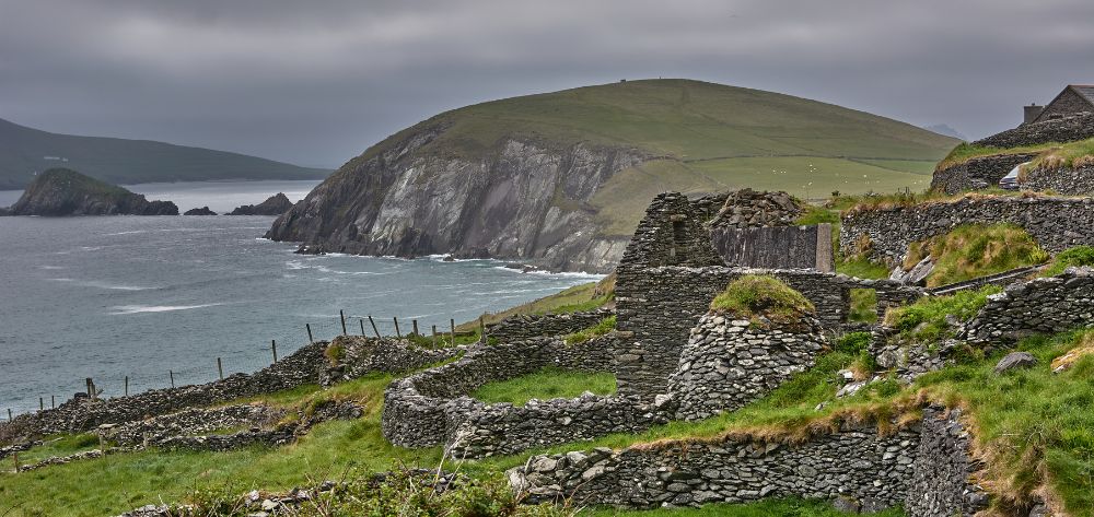
The Dingle Way walking route skirts the mountains of the Slieve Mish range, which form the spine of this long peninsula, jutting into the Atlantic Ocean. The mountains are rounded, not as high as their nearest neighbours on the Iveragh Peninsula, and formed from a beautiful old red sandstone that is always visible. Glaciation in the last Ice Age left coums and valleys, the natural harbours of Dingle and Ventry and a gentleness that never fails to impress. The western end is breathtaking – the Blasket Islands rear from the Atlantic calling to the sheltered haven of Dunquin (Dun Chaoin) before the mountains rise to the impressive bulk of Brandon, St. Brendan’s Mountain.
The peninsula is littered with remains from the early Christian period, oratories, beehive huts, megalithic tombstones, monastic enclosures, high crosses, to name a few. It is a spiritual awakening. Beautiful white sandy beaches, a temperate Gulf Stream climate and the profusion of strong colours in the flora – montbretia, fuchsia, purple loosestrife to name a few – make the Dingle Peninsula a wonderful location.
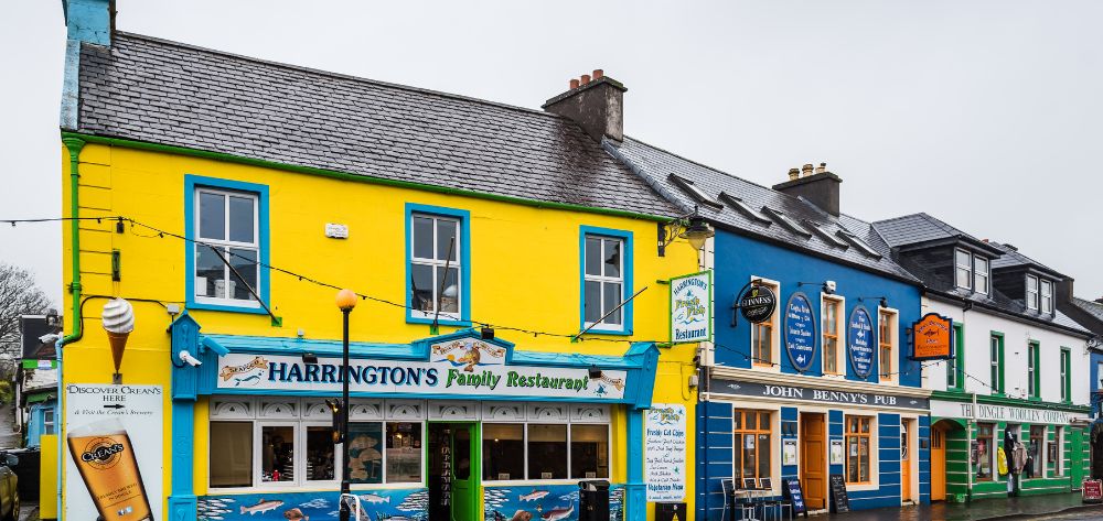
The town of Dingle retains its essential character attributed to a working fishing harbour. The steep streets have been reinvented with colourful tourist shops, craft outlets and a host of restaurants and pubs. There are still many local niches to enjoy the town behind the scenes. It is also the centre of one of Ireland’s most popular Gaeltacht regions, where 43% of households are predominantly Gaelic speakers, which adds a wonderful flavour to the local supermarkets!
Overnight stops (apart from Dingle) are in villages, allowing an opportunity to experience life with the locals and a chance to try Guinness and Gaelic.
To squeeze the best into our itineraries, we don’t include the Tralee to Camp section. We can include the first section for anyone who wishes to walk the full route.
Price Includes
Optional Extras
Pricing
The 10 day tour follows the same route as the standard 8 day itinerary, with additional days on the northern section offering a chance to climb Mount Brandon (Ireland’s second highest peak) and additional walking in Castlegregory.
This tour is rated STRENUOUS for one day and RELAXED for all other days.
See how we determine levels of difficulty for each of our hiking tours by visiting our FAQ page.
Travel to Camp via Tralee on scheduled bus service or by taxi. Camp is situated overlooking Tralee Bay to the north with the majestic Gearhane and Caherconree peaks to the east. It has been an historic crossing point of the Slieve Mish Mountains since the first settlers were here in 1700BC . Camp is a small settlement, with plenty of local colour and a short circular walk to limber up for the kilometers ahead!
Overnight accommodation in Camp village.
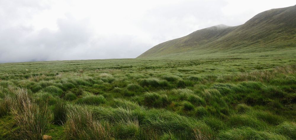
Hike to the south on turf cutting roads, through the glorious bogland of Slieve Mish – this wilderness of the blanket bog is punctuated with conifer forest and stacks of drying turf. Skirt Ardroe Hill, overlooking magnificent sand dunes at Inch Beach, with views south to the Ring of Kerry and Ireland’s highest mountain range, before following the “Maum” (pass) down to Annascaul village.
Distance 18.5km (11mi). Ascents 460m. Approximate walking time 6 hours.
Optional hike over Brackaloon Hill, add 5km (3mi) and 2 hours.
Overnight accommodation in Annascaul.
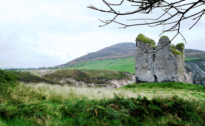
Follow Acres Hill to the staunch remains of 12th century Minard Castle, mostly destroyed by Cromwell’s army in 1650. Turn inland again on minor roads to the railway village of Lispole. All the way you are within scent of the seas of Dingle Bay and encircled by the Kerry Mountains. From Lispole, the Way follows mostly sheep farming country before climbing An Cnoc Maol Mor and descending the old green droving road into Dingle town.
Distance 23km (14mi). Ascents 460m. Approximate walking time 6-7 hours.
Overnight accommodation in Dingle town.
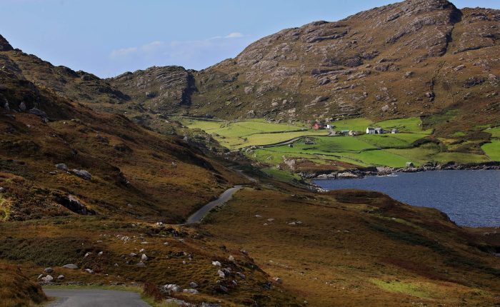
It is mostly minor roads and beaches today, but beyond the village of Ventry is some of the most spectacular scenery you could hope to find. The Way weaves through fuchsia hedges and climbs an old track on the foothill of Mount Eagle past the early Christian beehive huts at Fahan. Behind are views of Ventry Harbour and south to the Ring of Kerry and Valentia Island. Ahead the Way opens up to Slea Head and the Blasket Islands. Beyond this is America!
We included an alternative route over Mount Eagle, which is a gorgeous walk but is demanding and requires navigation skills. It is not advisable in poor weather conditions.
Distance 25km (16mi). Ascents 650m. Approximate walking time 7 hours.
Optional extra hike over Mount Eagle: 5km (3mi) and 2 hours.
Today’s route follows the Norse named Smerwick Harbour and a detour takes you to Dun an Oir, the Fort of Gold where Italian and Spaniard soldiers were besieged by troops of Elizabeth 1 in 1580. Ballydavid is a thriving fishing harbour and a Gaelic speaking community.
Distance 16km (10mi). Ascents 180m. Approximate walking time 6 hours.
Optional route over Cruach Mharthain add 1 hour.
Overnight accommodation in Ballydavid.
You are in the cradle of early Christian civilization here, with as many as sixty notable sites of cultural and religious development from the 5th to 9th centuries. Walk to Cloghane, climbing up to the saddle of Mas an Tiompain (the Pass of the Drum) below Mount Brandon. Take in the superb scenery of Tralee Bay and the Magharees against the hues of the Slieve Mish Mountains.
Distance 22km (14mi). Ascents 30m. Approximate walking time 7 hours.
Overnight accommodation in Cloghane.
Option 1: Climb Mount Brandon, Ireland’s second highest mountain at 951m. Ascents 950m. Approximate walking time 8 hours, only recommended in good weather and for experienced hikers.
Option 2: Walk to the Valley of Loch a Dúin, inhabited from the early Bronze Age. There are approximately eighty stone structures, wedge tombs, standing stones, cooking sites (fulacht fia) and rock art. Distance 10km (6mi). Ascents 100m. Approximate walking time 4 hours.
Overnight accommodation in Cloghane.
Today’s walk follows the coast all the way around the Castlegregory promontory or across the neck of it via Lough Gill, home to Bewick swans and Natterjack toads. We have 2 options for this route:
Option 1: Castlegregory via the long route around the coast. Distance 27km (17mi). Approximate walking time 8 hours.
Option 2: Castlegregory via the short route. Distance 12km (7mi). Approximate walking time 4 hours.
Overnight accommodation in Castlegregory.
A nice coastal route along Tralee Bay. The optional route visits the deserted village of Killelton, its inhabitants evicted by their landlord in the 19th century. There are also the remains of a 12th century oratory. It is a wonderful place with immense views of Tralee Bay.
Distance 10km (6mi). Ascents 80m. Approximate walking time 3 hours.
Alternate route via Killelton famine village: Distance 10km (6mi). Ascents 100m. Approximate walking time 3 hours.
Overnight accommodation in Camp village.
Scheduled bus services from Camp to Tralee (20 minutes) for onward connections.
August 2021 – Guido & Alicia, Switaerland
We just went back from ireland yesterday and let me tell: We really enjoyed our hiking tour around the dingle peninsula! Everything was perfect and well organized. Thank you so much.
July 2021 – Marie & Hans, Holland
Thank you for making our stay in Ireland so well. The last day we had to take the bad weather tour from Bally David. Everything we was wearing was wet. We got a lift to the pub with the owner and the dinner was super. We took a sticky tofee pudding , we were really worth it. The B&Bs were all very good. The food at Donquin was excellent.
June 2019 – Joan & Angelika, NY
Thanks for your note and even more so for arranging the trip. We had an absolutely amazing time. As you know the weather was perfect, as we we heard from everyone we met along the way very unusual and special for Ireland. This made for easy walking and brilliant scenery. It was not hard to imagine really needing “gaitors” along the way from Tralee to Camp! I think the only day that we had even the slightest bit of overcast was as we climbed Mt Brandon. This in fact, was much appreciated as the trails in the US generally have switchbacks, so the breeze and overcast skies made walking straight up just a little easier. (BTW we had full sun by the time we reached the top!) It did not keep us from dawdling a bit along the way, and we had time enough to take over 250 pics along the way to prove it! I can’t imagine deleting anything that we saw!
June 2019 – Anna & Dirk, Belgium
Just wanted to let you know that we had wonderful holidays in Ireland.
Walking “the Dingle Way” was an amazing experience- we truly enjoyed it.
This is really a gorgeous part of Ireland and the weather couldn’t be better.
May 2019 – Debbie & Peter, Auckland NZ
We did have a great trip!!!
We enjoyed hearing spoken Irish which is one of the things we felt made The Dingle peninsula particularly special. The weather was fantastic and we very much enjoyed all our hosts.
May 2019 – Cindy & Hazel ran the Dingle Way, Utah, USA
Great! The accommodations and hosts have been first rate. Also, the food in the villages has been excellent. Thank you for making lovely arrangements! The logistics have worked seamlessly so far.
May 2019 – Ivar & Daniel, Norway & California USA
We finished the Dingle Way last week and it was fantastic. The route was as advertised. Your notes were accurate and helpful. I could tell that you are walkers yourself and not just tour operators. Thanks!
I will thank you for the wonderful Dingle-trek . I am so impressed, by the nature, the friendly people, the excellent B&Bs, I have so many pictures, so many stories to tell my family and friends, and I hope to “walk with you” again.
+353 86 814 3156
info@tailor-madetours.com

