The Beara Way is a long distance walking route of 196km (120 miles) circumnavigating the Beara Peninsula in the southwest of Ireland. Beara is a quieter than its northern neighbour, the Kerry Way, but is equally beautiful and offers superb walking.
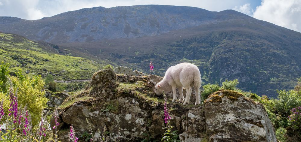
Hiking is through low rounded hills, walking old bog roads, exploring abandoned copper mines. It is a largely undiscovered area, hilly but not mountainous, with some good open hill-walking sections. The rocky coastline of the Beara Peninsula is a walking holiday dream. Visit Dursey Island by cable car, walk the green roads of Bere Island and sample the best fresh fish from the port of Castletownbere. The full trail starts at and finishes in Kenmare.
The Beara Way follows old green roads, boggy mountain trails and country roads. It is a very well marked route, signposted with numbered wooden or plastic yellow markers and road signs. This tour consists of 25% quiet country road walking.
The 10-day walking tour starts in Glengarriff village on the southeastern mouth of the peninsula and finishes in Kenmare. It includes a days walking to Dursey Island on the southwestern tip and the pretty village of Allihies.
Price Includes
Optional Extras
Pricing
The 10-day walking tour starts in Glengarriff village on the southeastern mouth of the peninsula and finishes in Kenmare. It includes a day of walking to Dursey Island on the southwestern tip and the pretty village of Allihies.
This tour is rated MODERATE for most days with two free days offering a RELAXED option. Day 9 is rated STRENUOUS.
See how we determine levels of difficulty for each of our hiking tours by visiting our FAQ page.
Travel to Glengarriff situated on beautiful Bantry Bay. Glengarriff means the “rugged glen” and is now a wooded and attractive valley. You may wish to visit Garinish Island, a planted sub-tropical garden about 10 minutes off the coast by ferry, famous for its Italian Garden and ancient sun temple.
Overnight in Glengarriff.
Walk through the Glengarriff woods and Glenlough Mountains, following old tracks alongside Coomarkane River, climbing the flank of the Sugarloaf, skirting mountain lakes to descend from Mass Mount and the Holy Well. Tonight’s evening meal will be in your guesthouse.
Distance 16km (10mi). Ascents 500m (1,640ft). Approximate walking time 5 hours.
Overnight in Adrigole.
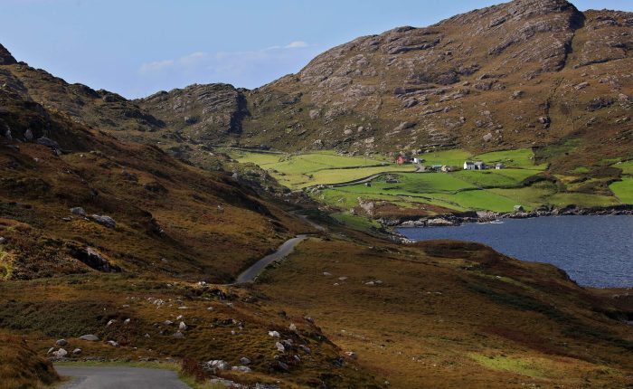
Wonderful views over Bantry Bay and a series of pre-historic sites close to the route. A series of bog roads, farm tracks and minor roads are linked today to cross the rugged slopes of Hungry Hill. Castletownbere, nestled in the lee of Bere Haven Harbour and sheltered by Bere Island, is the principal town of the peninsula and the largest whitefish port in Ireland.
Distance 22km (14mi). Ascents 450m (1,476ft). Approximate walking time 7 hours.
Overnight in Castletownbere.
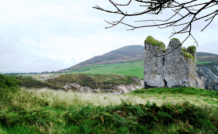
Free Day in Castletownbere to explore Bere Island and follow the Island Loop Ways. Walk through open sheep farming country, visiting Ardnakinna Lighthouse and a Martello Tower. Or on the mainland, visit Dunboy Castle, home to the O’Sullivan clan who ruled the area for three centuries.
Distance 18km (11mi) or 24km (15mi). Ascents 250m (820ft). Approximate walking time 6 hours.
Overnight in Castletownbere.
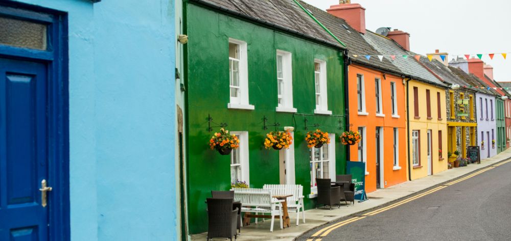
Through the Slieve Miskish Mountains, conifer forests, crossing open hill terrain under the peak of Knockgour at 481m. Pass a ringfort – an ancient farm enclosure, which would have served as a home for people and animals. Allihies is a colourful coastal village, surrounded by the remains of copper mines – crushed stones from the mines formed the beach.
Distance 16km (10mi). Ascents 220m (722ft). Approximate walking time 5 hours.
Overnight in Allihies.
Explore Allihies and the copper mines or take the cable car to Dursey, where you can explore deserted farming villages and stunning cliffs. The Dursey cable car is the only one of its type in Ireland. It was constructed in the 1973 and crosses a 200m strait approximately 25m above sea level. Your hosts will transfer you to the cable car station where you can walk back to Allihies.
Distance from Allihies via transfer to cable car is 12km (7.5mi).
You may wish to add walking on Dursey Island for a longer day.
Overnight in Allihies.
Mining tracks link Allihies with Eyeries and the views are to the north of Coulagh Bay and the mouth of the Kenmare River. The coastal route takes you past coastguard ruins and rocky shorelines to the Ballycrovane Standing stone.
Distance 20km (12mi). Ascents 500m (1,640ft). Approximate walking time 6 hours.
Overnight in Eyeries.
Climb the slopes of Gortbrack hill over the stunning Cleanderry Harbour to the pretty village of Ardgroom. Under the striated glaciated face of Tooreenamna and Coomacloghane there are no less than ten prehistoric monuments. The Owenashagh River meets Killmackillogue Harbour at Lauragh – a glorious sub tropical setting of rhododendron and Scot’s Pine. Dereen House and Gardens are well worth a visit.
Distance 22km (14mi). Ascents 300m (984ft). Approximate walking time 6 hours.
Overnight in Lauragh.
A minor road climbs to a saddle at 150m between the hills of Knockatee and Knockanoughanish, before climbing higher through open hillside. Superb views of the Cloonee Lakes descending to Lough Inchiquin and a stone circle from the Neolithic era 3500 – 2000 B.C. Descend into Kenmare town, an interesting market town founded in 1670 on the banks of the Roughty River.
Distance 24km (15mi). Ascents 470m (1,542ft). Approximate walking time 7 hours.
Overnight in Kenmare.
Depart by scheduled bus services from Kenmare to Killarney or Cork for onward connections.
August 2021 – K. Moshkowitz, New York, USA
I did want to let you know I had a wonderful trip! The Beara Way was just spectacular, and the B&B’s were lovely and the hosts as welcoming as could be. I didn’t make it to Allihies as that was the one day I had horrible weather, but the rest of the time I was out, was actually gorgeous. Thank you SO much.
July 2019 – G. Wickham, Virginia, USA
Thanks for checking in. We’ve had some beautiful days walking. Currently eating the best mussels ever in a pub near Lauragh!
July 2019 – N. Roest, The Netherlands
Just wanted to let you know i had a great Holiday! The Beara way was amazingly beautiful. Everything was perfectly arranged and all of the B&B’s I stayed in were great. Even the weather wasn’t too bad… Just 1 day and a half of rain…. Even got a lot of sun…! The Way itself is really beautiful. It has a few good challenges and the amount of road isn’t too much.
+353 86 814 3156
info@tailor-madetours.com

